The data driving Ossian
Will Laird, Measurements Lead, SSE Renewables
The Ossian project pushes boundaries to achieve its ambition to be amongst the biggest floating offshore wind farms anywhere on the planet.
At almost 900km2 and up to 3.6GW of installed capacity, it would be capable of generating enough clean, renewable energy to power up to six million homes annually.
But what sort of research and investigation is carried out to design the windfarm and understand the conditions of the project site, which sits 84km off the east coast of Scotland?
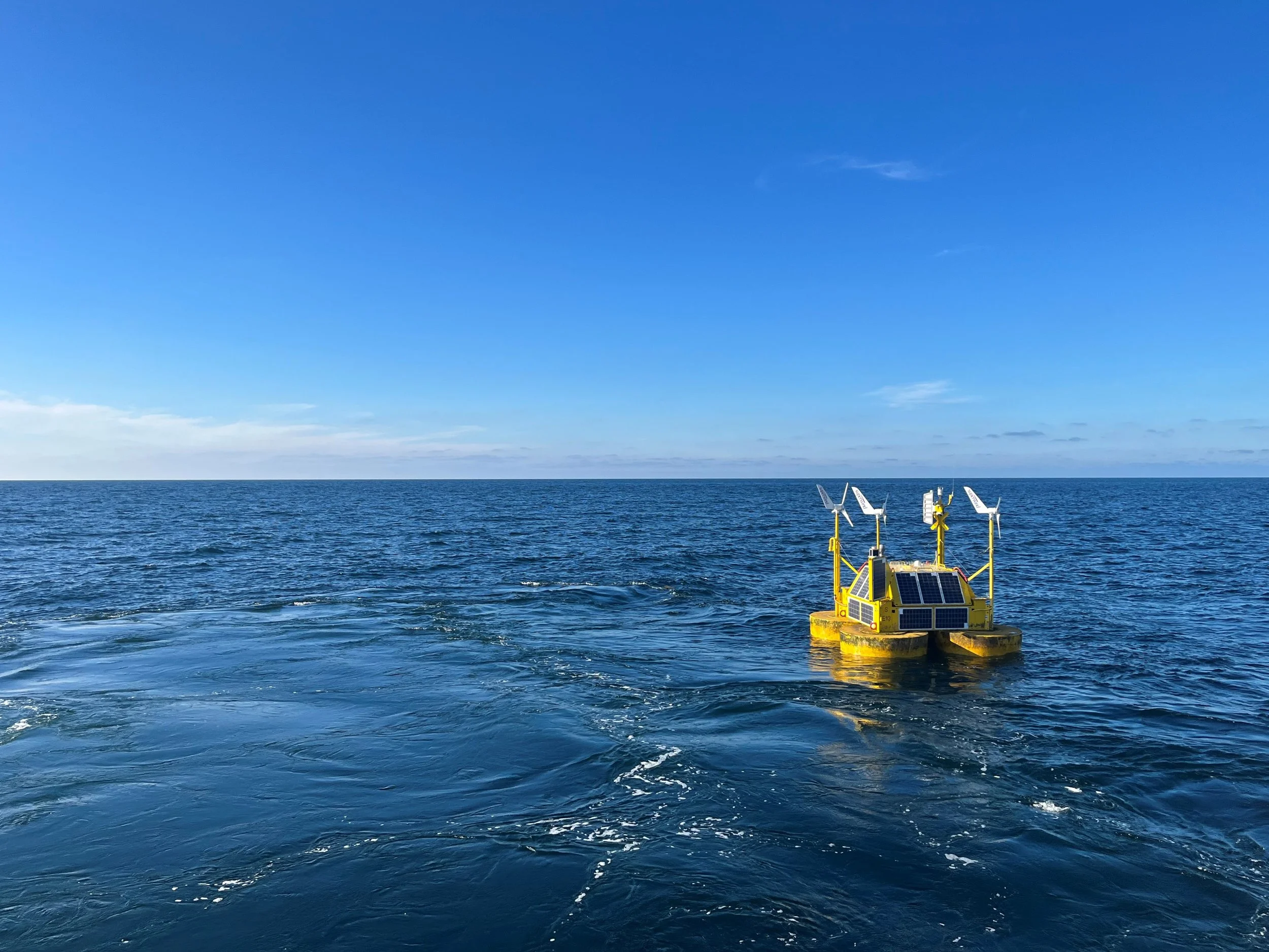
Floating lidar buoys
Earlier this year, our team completed a major milestone, a two-year measurement campaign gathering wind and sea state data that will underpin vital aspects of Ossian’s design.
I joined the project in 2023 having spent a decade working in renewable energy consultancy and technology development.
There were two main elements to the research, a metocean survey and the deployment of two floating lidar buoys.
This early-stage work is vital to minimise uncertainty in the project. The collected data supports everything from energy yield assessment to the turbine layout and predicting the environmental conditions that turbines, floating foundations, and moorings will have to endure in the North Sea.
The floating lidar buoys were stationed at two locations, one in the north and the other in south of the proposed project site.
Using Doppler lidar technology (which is like radar but using infrared light instead of radio waves as the sensing medium), the buoys measure wind speed and direction at ten heights up to a maximum height of 300m.
The findings are primarily used to predict the wind farm’s energy yield and identify the ideal turbine layout. The wind data can also be used to determine the size of the turbine that will be best suited to the conditions.
The North Sea is a harsh environment both to work in, and for the windfarm to endure during its lifespan. Over the course of the floating lidar campaign there were numerous named storms and meteorological challenges to overcome.
The metocean element of the campaign is critical to understanding sea state at the Ossian site. Waverider buoys measure the height, frequency, and direction of waves, while acoustic sensors below the water surface record current strength and direction. This information provides vital data that helps calculate the loads that will act on structures and informs the design of floating foundations, moorings and the turbine structures.
Knowing the sea state also gives essential insight into the working conditions, how often vessels can operate, and how often they will be hindered by adverse weather conditions.
Over the campaign 80 gigabytes of data were gathered, all of which will be used to determine not just the design of Ossian but also optimise its construction. This early-stage development is essential to ensure the project is a success.
As a member of the International Electrotechnical Commission committee for floating lidar, I helped shape the method and procedures that industry adhere to when using the measurement buoys.
Being part of the Ossian project offered me the opportunity to put these methods into practice on a nationally important infrastructure development.
There are many different paths available into the renewable energy sector, which typically welcomes people with relevant technical and managerial skills from many different industries. I’d encourage anyone with the desire to work at the forefront of energy technology development, look no further than the sector.